Analysis and network optimization
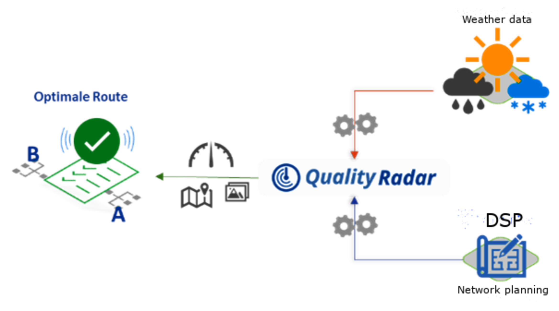
Our Quality Radar enables the planner to effectively implement network planning for his transport network & mobile backhaul by means of analyses, statistics and real-time evaluations, and to exclude potential disruption scenarios from the outset by means of a well-founded weak point analysis and process optimization.
The ultimate goal is quality assurance in network planning, which is why Mentopolis has developed a smart app via which complete monitoring and control of the operational network (KPI & risk analyses) becomes possible.
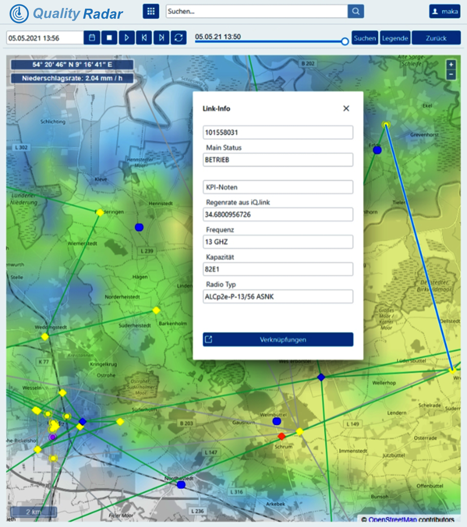
For this purpose, the Quality Radar accesses, for example, weather statistics (rain, snow, wind) in real time, compares them with the planned route and uses intelligent algorithms to determine how high the probability of disruption is for this part of the network.
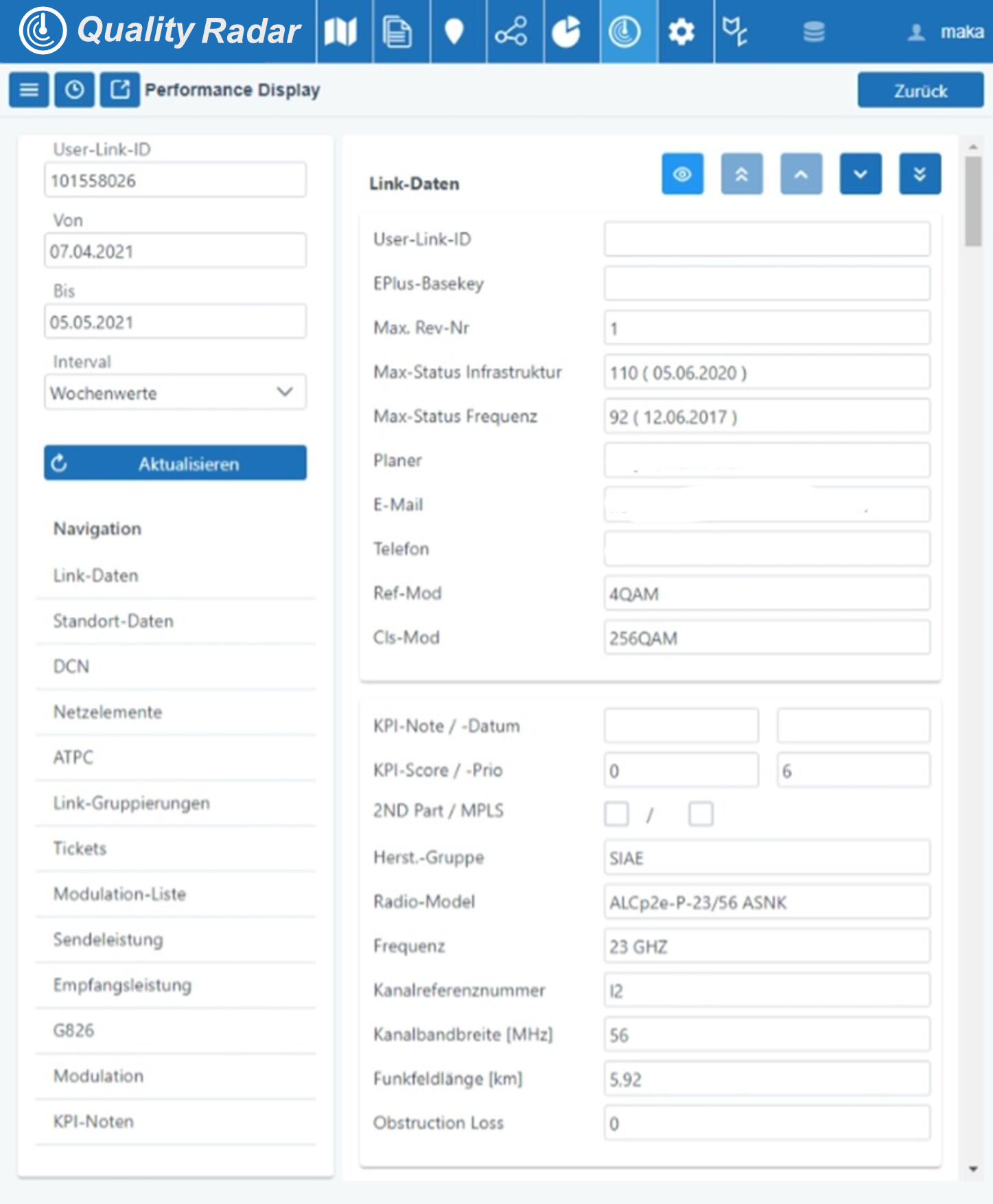
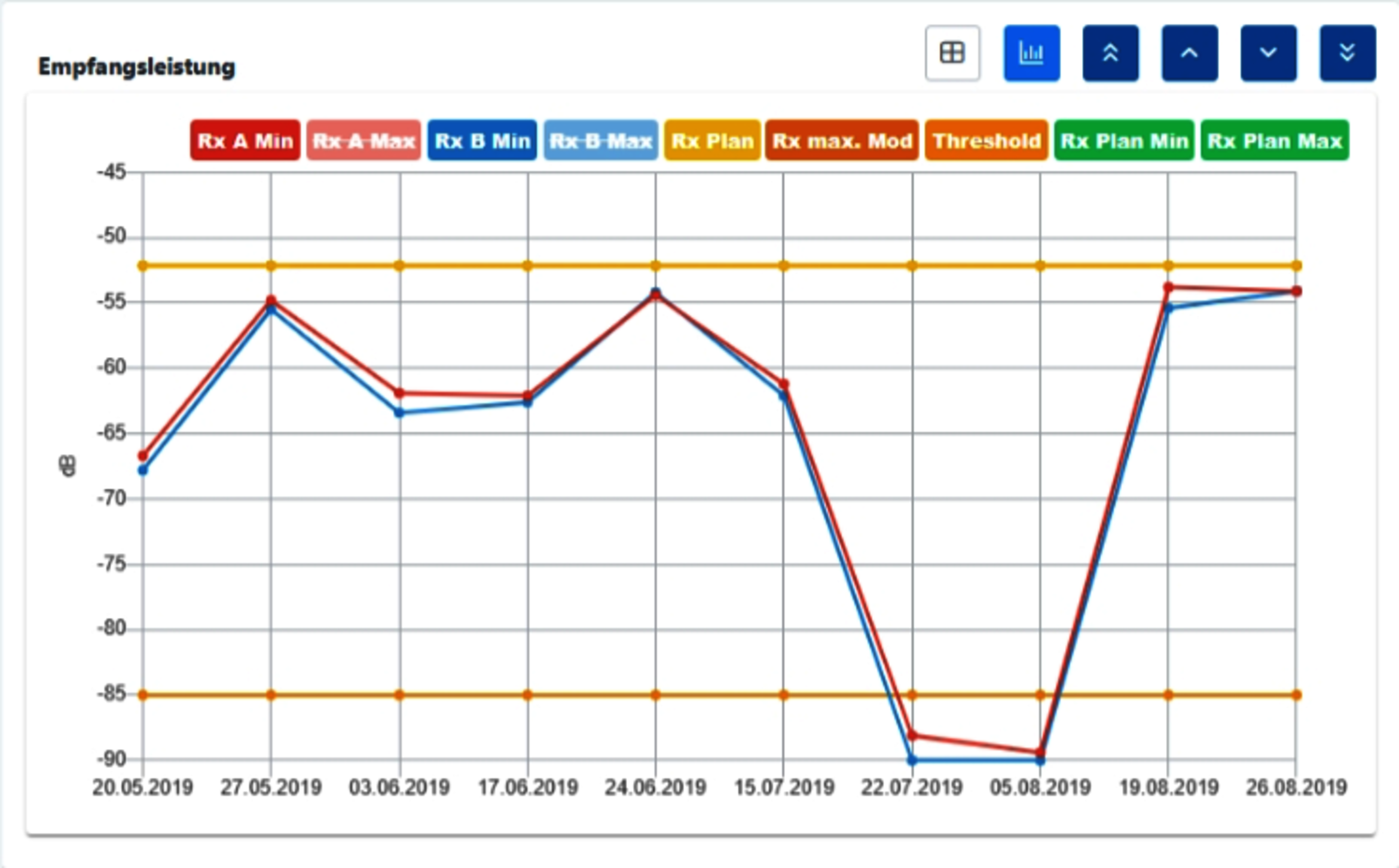
All decision-critical parameters of a route can be queried and evaluated in aggregated form via a corresponding. performance display and evaluated. In addition, detailed information (photos, aerial photos, etc.) on the locations of the A and B sides is available. The entire planning and control process is thus massively optimized through the reduced number of failures and malfunctions, time and cost savings, and error reduction.
QR Link Utilization
The expansion with 5G places high demands on the transport network. An ever-increasing level of networking through streaming services in 4K, working from home, always on & connected and, last but not least, the Internet of Things. All of this requires high capacity and availability in order to guarantee high-performance, stable and comprehensive coverage.
QR link utilization is a feature that deals with optimizing the use of radio links in the mobile network. It aims to improve the management and performance monitoring of the mobile network infrastructure. With the introduction of new performance data, the reading of values via SDN, an extended evaluation of connection alarms, the calculation of rain-related failures and other indicators, a more robust and reliable network environment is ensured that meets the growing requirements of mobile networks.


Real-time analysis
Performance characteristics / features
- 2-layer presentation (rain data and network)
- Presentation of current rain data as a movie with selectable point in time
- AdHoc presentation of network section (scalable and movable)
- High functionality with easy handling
- Trigger and selection from ticket system

Network optimization
Link Performance & Preventive Maintenance
- Interactive graphics
- Export options to PDF, Excel, Office
Network Design Review
- Evaluation of planned values,
- target values and effective network values
Utilization analysis
- (Methodical) analysis tools for the improvement of radio relay networks
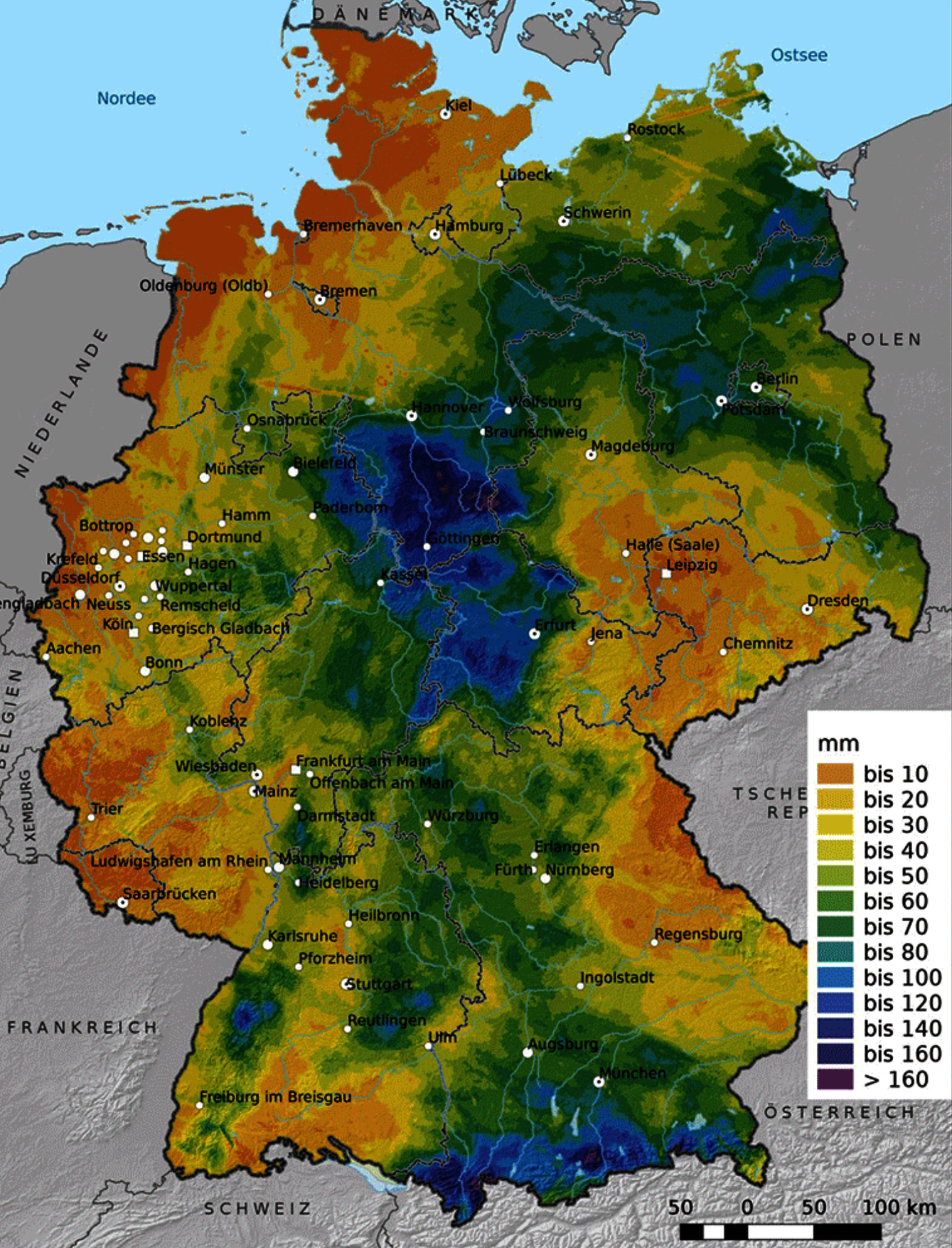
Rain models
Performance characteristics / features
- Interactive graphics (modulation etc.)
- High spatial & temporal resolution (tile and environmental data)
- Evaluation/analysis of regional rainfall radar base
- Comparison of planning specifications of network elements with current precipitation data
- Updating of planning models based on statistical weather data