Optimisation:
Link optimisation of network data with respect to local conditions.
Link planning can be optimised by overlaying resources such as topological or construction information (e.g. KML files) over the surrounding area.
Workflow:
Network data are managed and fully documented in a freely configurable process, allowing the lifecycle to be controlled and providing a transparent workflow as a working basis.
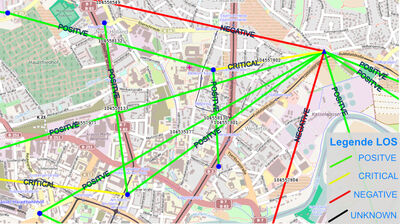
Location and LOS planning – Microwave link example
Thematic variables:
The diagram opposite shows a section from the LinkVis GIS module.
The thematic variables of the locations depend on the network elements set up there.
In contrast, the microwave links are coloured according to the system technology used.
Users can freely configure and modify thematic variables depending on the information required.


